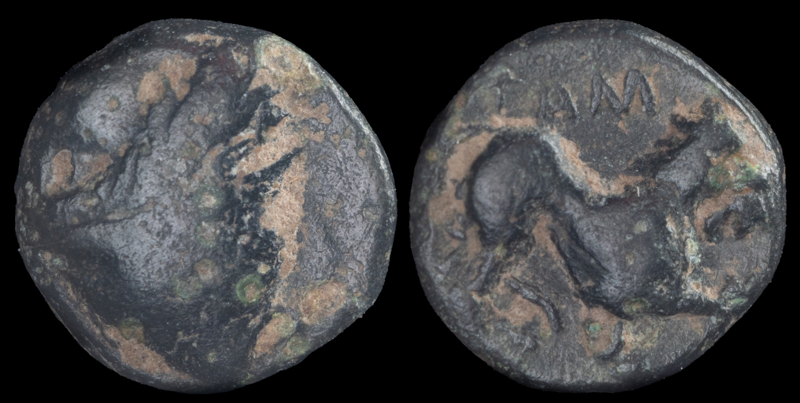
Tauric Chersonesos, Tamyrake
Circa 380-370 BCE
AE 8mm, 0.70g
Head of Kabeiros right, wearing conical hat decorated with laurel wreath /
T left, AM above, Lion at bay left within incuse square
Imhoof-Blumer KM Table XIX, 26
This is a rare example of a coin from Tamyrake, which wasn’t agreed on as an attribution until recently. Although Imhoof-Blumer originally attributed it over 100 years ago, it remained controversial until Leu found a diobol from Theodosia and Tamyrake with a common obverse die.
Per Strabo:
Then comes the Racecourse of Achilles, a peninsula that lies flat on the sea; it is a ribbon-like stretch of land, as much as one thousand stadia in length, extending towards the east; its maximum breadth is only two stadia, and its minimum only four plethra, and it is only sixty stadia distant from the mainland that lies on either side of the neck. It is sandy, and water may be had by digging. The neck of the isthmus is near the center of the peninsula and is about forty stadia wide. It terminates in a cape called Tamyrace, which has a mooring-place that faces the mainland. And after this cape comes the Carcinites Gulf.
This is pretty detailed, and I agree with Leu’s assertion that Tamyrake was located roughly per my map below.
Arrian’s description provides some useful measures, though the outlet of the lake is confusing.
From Chersonesus Taurica to Cercinetis six hundred stadia. From Cercinetis to Kalos Limen, a Scythian port, seven hundred stadia. From Kalos Limen to Tamyraca three hundred stadia. Within the limits of Tamyraca there is a small lake. From Tamyraca to the place where the lake discharges itself, three hundred stadia.
Nothing is known about the history of Tamyrake. Leu speculates it may have been destroyed by the locals, but we don’t really know. I found no information about archeological sites in the area. Today, significant archeology (though highly controversial) is occurring along the southern coast. My suspicion is the northern coast is too close to the war right now, though that doesn’t explain why there were no digs before the war. It’s possible that the coastline has moved considerably in the last 2400 years and any ancient cities in that area are now underwater. I did look up the area in by Barrington Atlas and found no sites in this area, nor any differences with the modern coastline. That doesn’t mean that there wasn’t any – only that no research appears to have been done.